Tuesday, September 28, 2010

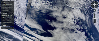
Earthquake Clouds for Sept. 28th 2010


Northeast U.S.

Northern New Zealand
UPDATE 9/29/10
**** NOTE - Was Originally Listed as a 6.4 Downgraded to 5.3!  That is a Huge Downgrade!****

Magnitude5.3
Date-Time
Location36.687°S, 177.018°E
Depth300 km (186.4 miles)
RegionOFF EAST COAST OF THE NORTH ISLAND, N.Z.
Distances175 km (110 miles) NNE of Rotorua, New Zealand
200 km (125 miles) E of Auckland, New Zealand
235 km (145 miles) NNW of Gisborne, New Zealand
550 km (340 miles) NNE of WELLINGTON, New Zealand
Location Uncertaintyhorizontal +/- 15.9 km (9.9 miles); depth +/- 7.1 km (4.4 miles)
ParametersNST= 77, Nph= 83, Dmin=150.3 km, Rmss=1.28 sec, Gp= 61°,
M-type=body wave magnitude (Mb), Version=6
Source
  • USGS NEIC (WDCS-D)
Event IDus2010buak

Russia


Tasmania, yet again

Sunday, September 26, 2010

Earthquake Cloud areas for Sept 26th 2010

Pacific Northwest into Canada


New Zealand
UPDATE - 9/29/10  there have been over 20 quakes around the 3 Magnitude in the last 3 days.
Examples of them below.

South of France and Monaco area to Italy
UPDATE 10/4/10
MagnitudeML 2.7
RegionFRANCE
Date time2010-10-04 09:32:02.9 UTC
Location44.37 N ; 3.13 E
Depth9 km
Distances103 km NW Montpellier (pop 248,252 ; local time 11:32 2010-10-04)
29 km N Millau (pop 23,307 ; local time 11:32 2010-10-04)
7 km NE Sévérac-le-château (pop 2,565 ; local time 11:32 2010-10-04)

UPDATE 9/28/10

MagnitudeML 3.3
RegionNORTHERN ITALY

Maritime Alps
Date time2010-09-29 01:46:42.9 UTC
Location44.51 N ; 7.32 E
Depth10 km
Distances69 km SW Turin (pop 872,881 ; local time 03:46 2010-09-29)
20 km SW Saluzzo (pop 16,300 ; local time 03:46 2010-09-29)
6 km NW Dronero (pop 7,172 ; local time 03:46 2010-09-29)

** Note** I still think something will hit in the South of France, though this quake was east of the ripples.

Thursday, September 23, 2010

Earth Quake Cloud Pictures for 9/23/10

Off Baja Coast

UPDATE 9/29/10

Magnitude4.2
Date-Time
Location25.695°N, 110.187°W
Depth10 km (6.2 miles) set by location program
RegionGULF OF CALIFORNIA
Distances120 km (75 miles) ESE of Loreto, Baja California Sur, Mexico
120 km (75 miles) W of Los Mochis, Sinaloa, Mexico
170 km (105 miles) SSW of Navojoa, Sonora, Mexico
1335 km (820 miles) WNW of MEXICO CITY, D.F., Mexico
Location Uncertaintyhorizontal +/- 24.8 km (15.4 miles); depth fixed by location program
ParametersNST= 38, Nph= 38, Dmin=736 km, Rmss=1.09 sec, Gp=266°,
M-type=body wave magnitude (Mb), Version=7
Source
  • USGS NEIC (WDCS-D)
Event IDus2010buau


North Eastern Coast U.S. to Nova Scotia Area
UPDATE 9/26/10

Magnitude3.1
Date-Time
Location43.291°N, 71.657°W
Depth3.4 km (2.1 miles)
RegionNEW HAMPSHIRE
Distances15 km (10 miles) NW of CONCORD, New Hampshire
30 km (20 miles) SSW of Laconia, New Hampshire
35 km (25 miles) NNW of Manchester, New Hampshire
55 km (35 miles) W of Rochester, New Hampshire
Location Uncertaintyhorizontal +/- 0.9 km (0.6 miles); depth +/- 1.7 km (1.1 miles)
ParametersNST= 20, Nph= 34, Dmin=19.8 km, Rmss=0.47 sec, Gp=101°,
M-type="Nuttli" surface wave magnitude (mbLg), Version=a
Source
Event IDne00001198

North Eastern China

Tasmania

Sunday, September 19, 2010

9/19/10 EQ cloud Areas - A few unique places showing Earth Movement

Tasmania


Pacific Coast of Central America
UPDATE 9/24/10
MAP 4.5 2010/09/24 01:28:00    15.705 -93.248  86.0   CHIAPAS, MEXICO
MAP 4.8 2010/09/23 09:58:34    12.796 -88.458  69.9   OFFSHORE EL SALVADOR

Mid to Southern Indian Ocean

Off Coast Ecuador and Columbia and Peru
UPDATE 9/30/10
Magnitude4.4
Date-Time
Location6.845°N, 73.172°W
Depth160.5 km (99.7 miles)
RegionNORTHERN COLOMBIA
Distances30 km (20 miles) S of Bucaramanga, Colombia
80 km (50 miles) ESE of Barrancabermeja, Colombia
135 km (85 miles) SSW of Cucuta, Colombia
270 km (165 miles) NNE of BOGOTA, Colombia
Location Uncertaintyhorizontal +/- 17.2 km (10.7 miles); depth +/- 14.5 km (9.0 miles)
ParametersNST= 61, Nph= 65, Dmin=254.9 km, Rmss=0.68 sec, Gp= 68°,
M-type=body wave magnitude (Mb), Version=6
Source
  • USGS NEIC (WDCS-D)
Event IDus2010bvb7

UPDATE 9/25/10

Magnitude5.6
Date-Time
Location7.790°S, 74.358°W
Depth148.8 km (92.5 miles)
RegionNORTHERN PERU
Distances70 km (40 miles) NNE of Pucallpa, Peru
195 km (120 miles) W of Cruzeiro do Sul, Acre, Brazil
315 km (195 miles) NE of Huanuco, Peru
560 km (350 miles) NNE of LIMA, Peru
Location Uncertaintyhorizontal +/- 16.4 km (10.2 miles); depth +/- 0.5 km (0.3 miles)
ParametersNST=346, Nph=393, Dmin=997.4 km, Rmss=0.77 sec, Gp= 22°,
M-type=body wave magnitude (Mb), Version=6
Source
  • USGS NEIC (WDCS-D)
Event IDus2010bpbd

Solvenia Croatia area
UPDATE 10/9/10 - 

MagnitudeML 2.6
RegionSLOVENIA
Date time2010-10-07 20:37:17.2 UTC
Location45.58 N ; 14.23 E
Depth2 km
Distances32 km NW Rijeka (pop 141,172 ; local time 22:37 2010-10-07)
38 km E Muggia (pop 13,175 ; local time 22:37 2010-10-07)
1 km N Ilirska bistrica (pop 4,846 ; local time 22:37 2010-10-07)

UPDATE 10/4/10

MagnitudeML 2.6
RegionADRIATIC SEA
Date time2010-10-04 06:07:16.8 UTC
Location44.80 N ; 14.86 E
Depth2 km
Distances68 km SE Rijeka (pop 141,172 ; local time 08:07 2010-10-04)
80 km W Bihac (pop 75,641 ; local time 08:07 2010-10-04)
8 km NE Banjol (pop 1,981 ; local time 08:07 2010-10-04)

UPDATE - 9/24/10 - There has not been an official Earthquake reported, yet something odd has happened in Solvenia. People heard a huge bang 2 days ago and now a river is completely dry.
Link is to a page I have translated to English.

Wednesday, September 15, 2010

New Photos - Areas 9 /15/10

It has been awhile since I have posted anything.  Flash Earth became very unreliable - they would keep the same clouds on for 2 weeks or more.  I can tell they are recent clouds today, due to Hurricane Igor in the Atlantic.  The below are where I see EQ clouds.

North East

UPDATE - 9/19/10 - 3 Quakes today in the North East Area

MAP 2.7 2010/09/19 16:57:08 46.177 -74.548 0.1 61 km ( 38 mi) NW of Saint-J�r�me, Canada
MAP 2.9 2010/09/19 16:47:29 46.182 -74.561 0.0 62 km ( 39 mi) NW of Saint-J�r�me, Canada
MAP 1.3 2010/09/19 00:49:17 43.779 -74.166 1.7 32 km ( 20 mi) NNE of Speculator, NY

Off East Coast of Alaska

UPDATE 9/24/10
MAP3.4 2010/09/23 22:07:09 57.271-154.726 -9.9 41 km ( 25 mi) SSW of Karluk, AK
MAP3.2 2010/09/22 17:25:06 56.883-155.697 57.8 93 km ( 58 mi) W of Akhiok, AK

Canada - Eastern Area

UPDATE 9/24/10
Sunday September 19, 2010
Local Time: 12:57:07 EDT
Magnitude: 3.3 MN
Latitude: 46.29 North
Longitude: 74.52 West
UT Date
and Time:
2010-09-19
16:57:07 UT

Off the Coast of Chile
UPDATE 9/24/10 -

MAG UTC DATE-TIME
y/m/d h:m:s
LAT
deg
LON
deg
DEPTH
km
 Region
MAP 5.3 2010/09/23 16:36:18   -34.879 -71.612  44.5   LIBERTADOR O'HIGGINS, CHILE
MAP 4.8 2010/09/20 13:44:41   -37.944 -75.015  25.5   OFF THE COAST OF BIO-BIO, CHILE
MAP 5.4 2010/09/20 05:42:56   -33.700 -72.041  28.9   OFFSHORE VALPARAISO, CHILE


Mid Pacific Close to Antarctica - very interesting mixture of EQ clouds going on.

Eastern Coast area of Africa - Mozambique 
UPDATE 10/14/10 - 
I have to admit - I put this picture in, but was not sure a quake would really happen, since it is such an unusual area that does not get quakes.  In saying that... here we go.

Magnitude5.2
Date-Time
Location10.306°S, 42.832°E
Depth15.3 km (9.5 miles)
RegionCOMOROS REGION
Distances160 km (100 miles) NNW of MORONI, Comoros
290 km (180 miles) E of Mtwara, Tanzania
330 km (205 miles) NE of Ibo, Mozambique
380 km (235 miles) NW of MAMOUDZOU, Mayotte
Location Uncertaintyhorizontal +/- 19.4 km (12.1 miles); depth +/- 0.3 km (0.2 miles)
ParametersNST=157, Nph=158, Dmin=>999 km, Rmss=0.94 sec, Gp= 29°,
M-type=body wave magnitude (Mb), Version=6
Source
  • USGS NEIC (WDCS-D)
Event IDusa000400p
Sumatra Area

UPDATE - 9/19/10
Magnitude 4.9
Date-Time

* Sunday, September 19, 2010 at 11:10:20 UTC
* Sunday, September 19, 2010 at 05:10:20 PM at epicenter
* Time of Earthquake in other Time Zones

Location 11.031°N, 94.987°E